Home

Menu

You are here

Transportation

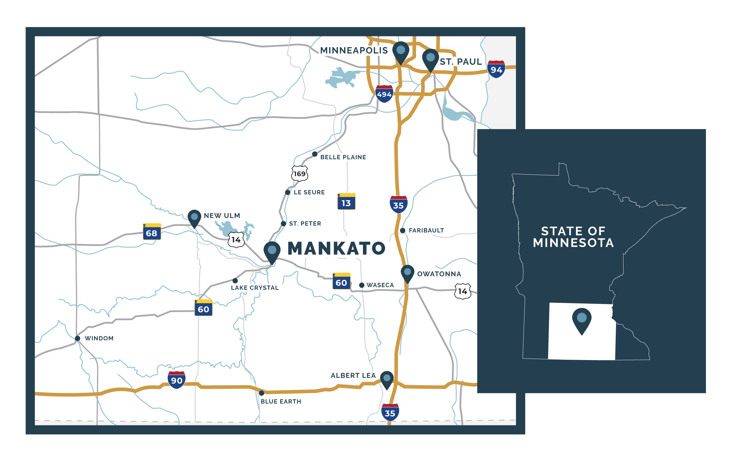
Greater Mankato is strategically located relative to all of southern Minnesota, as well as to the Minneapolis/St. Paul area. Major highways connecting Greater Mankato and the surrounding area are enhanced to accommodate the dramatic growth in economic activity throughout the region. With a state-of-the-art regional airport, trucking services and rail access, Greater Mankato offers an efficient Midwest gateway to U.S. and global markets.


Maps >


Highways

State Highway 22 | North to St. Peter and Hwy 169 to Twin Cities South to Iowa border

State Highway 60 | West to St. James, Worthington and Interstate 90 East to Faribault and Interstate 35

US Highway 14 | East to Owatonna, Rochester West to New Ulm and South Dakota border

US Highway 169 | North to Twin Cities and surrounding suburbs South to Blue Earth and Interstate 90

Interstate Highways | Accessible in less than a one-hour drive


Trucking

Numerous truck lines serve the area, with several maintaining terminal facilities locally.  Local carriers are capable of handling all types of freight.


Rail Distribution

Union Pacific (UP)

Dakota, Minnesota & Eastern (DM&E)

Map of Rail System in Minnesota


Charter and Corporate Air Service

The Mankato Regional Airport serves as a vital transportation component for the region. A new 6,600-foot runway was completed in 2007 to allow larger aircraft (up to a 737) to utilize the facility. The airport leases 86 indoor hanger spaces and is used by a steady stream of corporations to accommodate their travel needs. The Mankato Regional Airport also offers chartered flight services, and scheduled commercial flights are available a short 75-minute drive to the Minneapolis-St. Paul International Airport.


Mankato Regional Airport

Northstar Aviation

Minneapolis-St. Paul International Airport


The Greater Mankato Growth, Inc. Family: Visit Mankato City Center Partnership